

- cross-posted to:
- nebula@lemmy.world
- cross-posted to:
- nebula@lemmy.world
You must log in or register to comment.
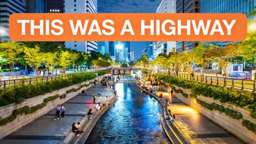
I lived in Busan at the time this project was done, and visited Seoul only a few weeks after it opened. I didn’t know anything about urbanism at the time, I just knew it was such an incredibly nice place to be.
What’s the coordinates or name. I want to explore this from satellite maps.
It’s called Cheonggyecheon, 청계천. Google Maps in Korea is really, really poor (for legal reasons). The satellite quality doesn’t even come close to capturing this (you can barely even tell it’s there), and Street View is just from the road (as of 2018 at the most recent) where you can see that it’s there, but not get much of a sense of it. There are a very small number of those individual non-path Street View photos.
Thanks. There are actually quite a lot of good street view of it. Some even on the sidewalk inside.
But yeah you can’t see shit from satellite views because the tall buildings block everything ahah.
Kind-of similar to what they did in Utrecht. In the 1960s, they built a stub for a highway in part of the Utrecht canal. Then in the 2010s they turned it back into the canal it once was. And it led to a MUCH better atmosphere.
Great video, very disappointing sponsorship
Sponsorship? This is the Nebula version, there wouldn’t be any sponsorship. Did he accidentally leave it in and I just blanked that out?
Oh! Sorry, I watched the youtube version (which has a bit of a shady sponsor)