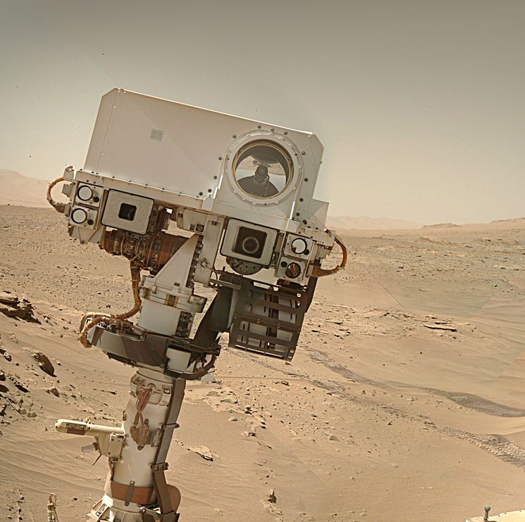
From what I can see, the colour image featured in this post is not vertical - it’s actually a close-up image from the microscope on the end of the rover’s robotic arm, which you can see placed over the target in this image, taken less than an hour after the microscopic image. The slope on which this rock/outcrop is found is well below 45º, or the rover’s wheels wouldn’t be resting on it. You can see a wider view of the rock adjacent to the target in this image from the same sol (if you’re interested, here are all the images taken on sol 4513).
That being said, your question is pertinent. Yes, I would call them layers also. There has clearly been deposition here - a lot of it - but erosion has shaped the landscape here in interesting ways too (this latter image was also taken on 4513).
The thing about folding is that it doesn’t occur in insolation, or only in very small areas; it’s generally a response to forces that act on regional scales. If there were folding at the rover’s current location, it would likely be visible in the surrounding countryside, including possibly on the towering layered ridges that now surround the rover.
Even for geologists, this field site makes you think.
Those formations are quite interesting. Funny what heat, cold, wind and radiation can do when you give them enough time.
If I understand you correctly, the camera faces downwards towards towards a horizontal or only slightly sloped surface? In this case the deposition layers are horizontal as they should be, or not?
If they aren’t it would indeed be an interesting geological puzzle to solve.
If you will pardon the late reply:
From what I can see, the colour image featured in this post is not vertical - it’s actually a close-up image from the microscope on the end of the rover’s robotic arm, which you can see placed over the target in this image, taken less than an hour after the microscopic image. The slope on which this rock/outcrop is found is well below 45º, or the rover’s wheels wouldn’t be resting on it. You can see a wider view of the rock adjacent to the target in this image from the same sol (if you’re interested, here are all the images taken on sol 4513).
That being said, your question is pertinent. Yes, I would call them layers also. There has clearly been deposition here - a lot of it - but erosion has shaped the landscape here in interesting ways too (this latter image was also taken on 4513).
The thing about folding is that it doesn’t occur in insolation, or only in very small areas; it’s generally a response to forces that act on regional scales. If there were folding at the rover’s current location, it would likely be visible in the surrounding countryside, including possibly on the towering layered ridges that now surround the rover.
Even for geologists, this field site makes you think.
:)
Those formations are quite interesting. Funny what heat, cold, wind and radiation can do when you give them enough time.
If I understand you correctly, the camera faces downwards towards towards a horizontal or only slightly sloped surface? In this case the deposition layers are horizontal as they should be, or not?
If they aren’t it would indeed be an interesting geological puzzle to solve.