
You must log in or register to comment.
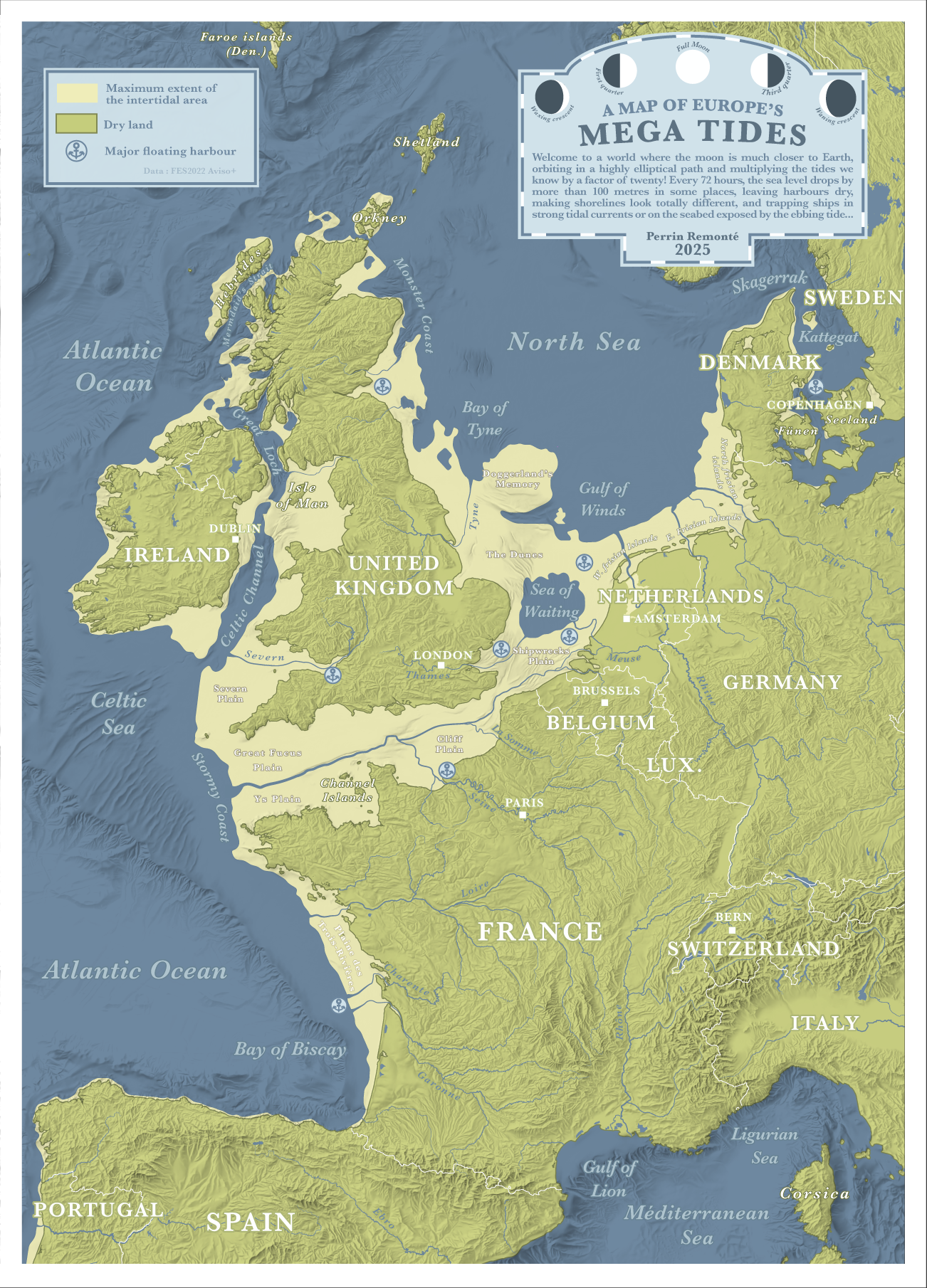
Erm … if in such a scenario sea-level drops 100m below current shoreline at low tide, wouldn’t it rise nearly 100m at high tide - assuming the total volume of the ocean being the same ? In which case the dry-land coastline would be much further inland.
Wouldn’t the tides go up and down? map seems to show down only
I understand it as both, as the tides would occupy the yellow zones when up
But the green zones are current shorelines.
Author’s comment to that question: https://old.reddit.com/r/MapPorn/comments/1l1aga3/europes_mega_tides_what_if_tides_were_20_times/mvjomt9/
Their answer is “idk lol”.
Which means they didn’t consider it. Of course lower low tides also mean higher high tides, the water has to go somewhere.