New satellite images commissioned by the BBC reveal the extent of destruction across northern Gaza, before the start of the temporary ceasefire between Israel and Hamas.
While northern Gaza has been the focus of the Israeli ground offensive and has borne the brunt of the destruction, widespread damage extends across the entire strip.
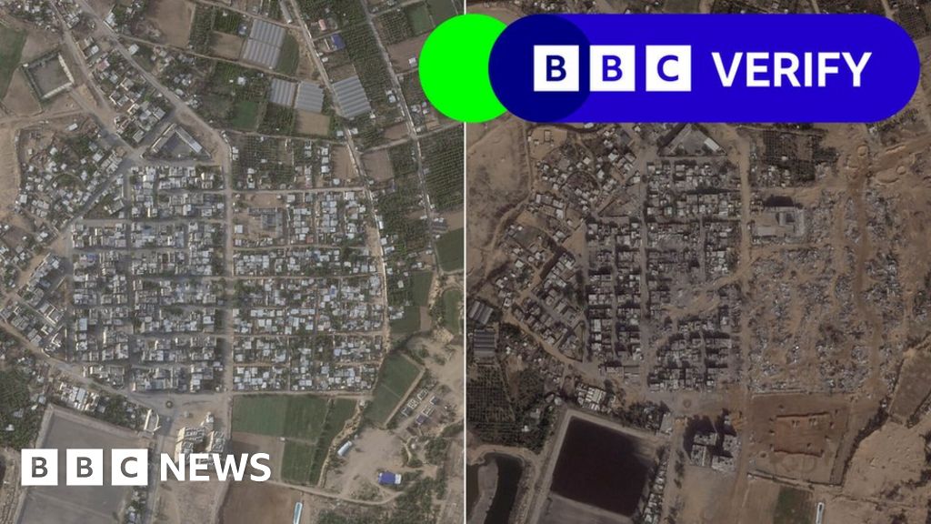
In this image below, taken to the south of Gaza City, we can see what was previously a populated residential area, cleared by the IDF with heavy machinery and a road bulldozed towards the western Mediterranean shoreline.
Satellite images also show an open square of land with a Star of David carved into the earth by vehicle tracks in Gaza City, near al-Azhar University.
Images online from before the war showed children playing there and suggested it was a park, but IDF spokesman Rear Adm Daniel Hagari said the ground was used by Hamas as a parade square near a base.
Additional reporting by Thomas Spencer, Paul Brown, Jake Horton, Alex Murray and Shayan Sardarizadeh and Jemimah Herd
The original article contains 946 words, the summary contains 171 words. Saved 82%. I’m a bot and I’m open source!

This is the best summary I could come up with:
New satellite images commissioned by the BBC reveal the extent of destruction across northern Gaza, before the start of the temporary ceasefire between Israel and Hamas.
While northern Gaza has been the focus of the Israeli ground offensive and has borne the brunt of the destruction, widespread damage extends across the entire strip.
In this image below, taken to the south of Gaza City, we can see what was previously a populated residential area, cleared by the IDF with heavy machinery and a road bulldozed towards the western Mediterranean shoreline.
Satellite images also show an open square of land with a Star of David carved into the earth by vehicle tracks in Gaza City, near al-Azhar University.
Images online from before the war showed children playing there and suggested it was a park, but IDF spokesman Rear Adm Daniel Hagari said the ground was used by Hamas as a parade square near a base.
Additional reporting by Thomas Spencer, Paul Brown, Jake Horton, Alex Murray and Shayan Sardarizadeh and Jemimah Herd
The original article contains 946 words, the summary contains 171 words. Saved 82%. I’m a bot and I’m open source!